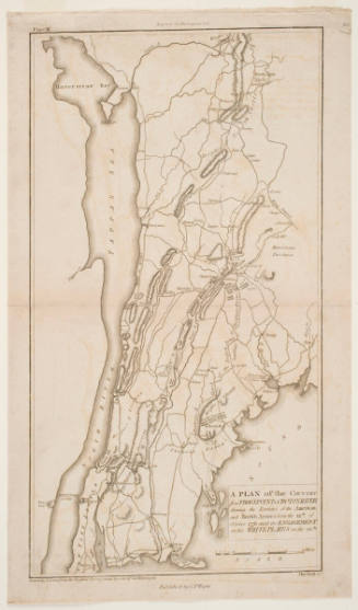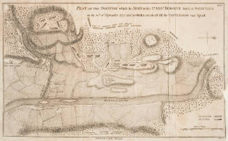
A Map of Part of Rhode Island Shewing the Positions of the American and British Armies at the Siege of Newport, and the Subsequent Action on the 29th of August 1778
Artist
Benjamin Jones
Date1807
Mediumengraving on cream laid paper
Dimensionssheet: 46.4 x 28.8 cm (folded in half horizontally)
ClassificationsMaps, charts and plans
Credit LineCharles E. Goodspeed Collection
Object number1910.48.1681
DescriptionEngraved for Marshall's Life of Washington (Philadelphia, 1807)On View
Not on view