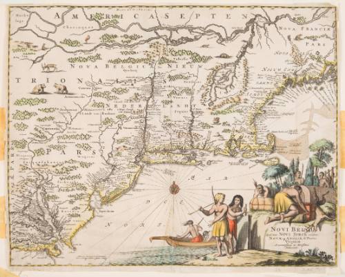
after Map of American Eastern Seaboard from Chesapeake Bay to Penobscot Bay
Artist
John Ogliby
and (Scottish, 1600–1676)
Artist
Arnoldus Montanus
(Dutch, about 1625–about 1683)
Dateabout 1670, published 1671
Mediumengraving with stipple engraving and handcoloring on paper
Dimensionssheet: 28.8 × 36.4 cm (11 5/16 × 14 5/16 in.)
ClassificationsMaps, charts and plans
Credit LineBequest of Robert Dudley Harrington Revocable Trust
Object number2017.82
Descriptionpublished in "Die Nieuwe en Onbekende Weereld".On View
Not on view

1800s